
Tracking
Fleet Page Overview
Select the Fleet tab from the main navigation to access the Fleet page.
The Fleet page displays an interactive map showing all your assigned vessels.
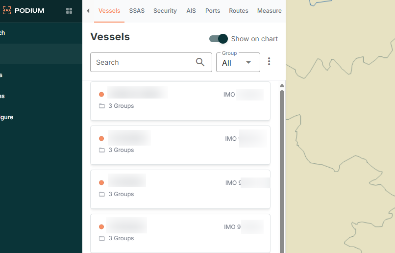
- The vessel list appears on the left-hand side of the page.
- Select any vessel to view its current position on the map.
The Fleet page contains multiple sub-tabs:
- Vessels - Displays the list of all vessels with basic information. Select a vessel to view details, or select Full Details for comprehensive information.
- SSAS - View and manage SSAS alerts for all configured vessels.
- Security - Displays security incidents and piracy events in the selected date range.
- AIS - Search for vessels by name, callsign, IMO, or MMSI, or view vessels in a specific vicinity.
- Ports - Shows port locations and information on the map.
- Routes - Provides access to route planning tools.
- Measure - Calculate distances between ports or positions.
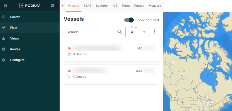
Chart Overlays and Features
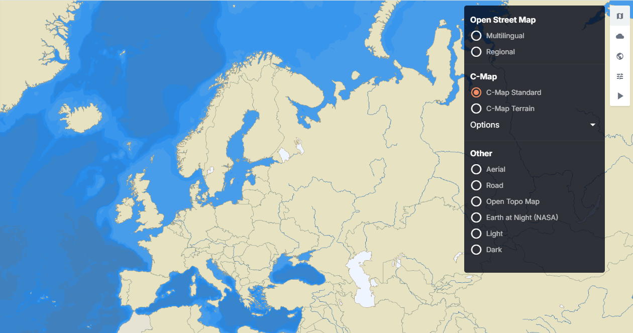
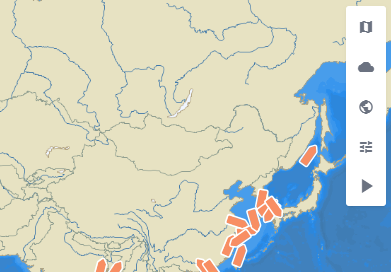
Here you can select 3 icons located in the top-right corner of the map.
- Map Icon (Map Style) - select this function to toggle and change the map to any of the available alternative map views such as:
- Open Street Map - Multilingual/Regional
- C-Map - C-Map Standard/Terrain
- Other:
- Aerial
- Road
- Open Topo Map
- Earth at Night (NASA)
- Light
- Dark
- Cloud icon (Weather)- select this function to toggle to access weather and sea state overlays. Toggle overlays on or off for options such as - Adjust overlay opacity using the slider at the bottom of the weather menu.
- Wind
- Wave
- Current
- Advanced.
- World icon (Global Overlays) - Global Overlays for specific features
- Geo Zones
- Historic Density Maps
- Global AIS Positions
- AIS Playback
- Cog Icon (Settings)
- Enable/Disable Live Sync
View and Manage Vessels
You can view and manage vessels in various methods within Podium.
- Select a vessel from the vessel list to view its current position on the map.
- The map displays the vessel icon with a course indicator showing direction of travel.
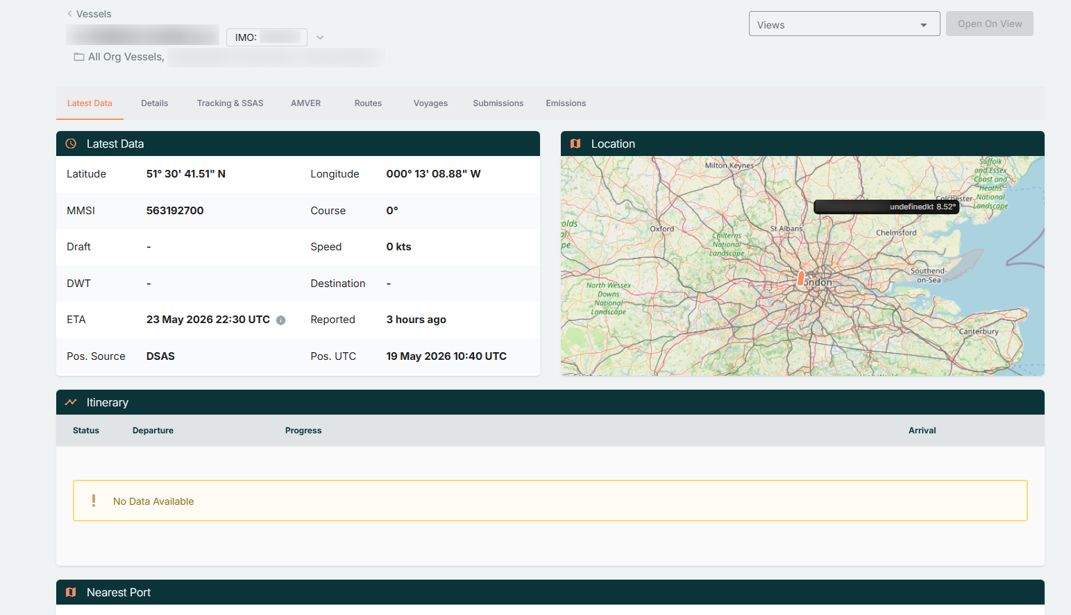
- Select Full Details to open the vessel details page, which includes tabs such as:
- Latest Data - You can view the latest positional data for the vessel, including Map location, Itinerary and nearest Port.
- Details - You can view the Vessel Details and Historical Position Reports.
- Tracking & SSAS - Here will be details of the active Communicator for the vessel, where you can initiate SSAS testing via the Test Mode function. In addition, this will be where the SSAS Contacts can be configured.
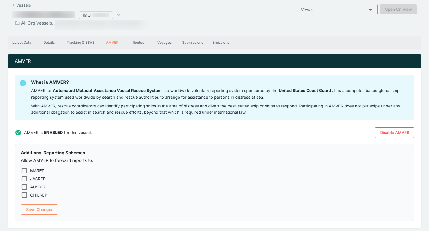
- AMVER - You can enable/disable AMVER for the vessel.
- Routes - You can view all assigned routes for the vessel, and also have the option to create new routes.
- Voyages - This is a section where you can view/create voyages for the vessel.
- Submissions - All submitted Noon Data Reports will be shown here. (*Advanced Feature)
- Emissions - You can view the specific vessel information applicable for Emissions and review analytical data based off Noon Data Report submissions. (*Advanced Feature)
- Use the search bar at the top left corner of the page, to quickly locate specific vessels.
Filter vessels using the dropdown menu 'Group' to display all vessels or created vessel groups.
Manage Late / Missing Reports
- On the main fleet page, select Vessels -> navigate to the ellipsis icon and select Late / Missing Reports -> Select and enable the required data source.
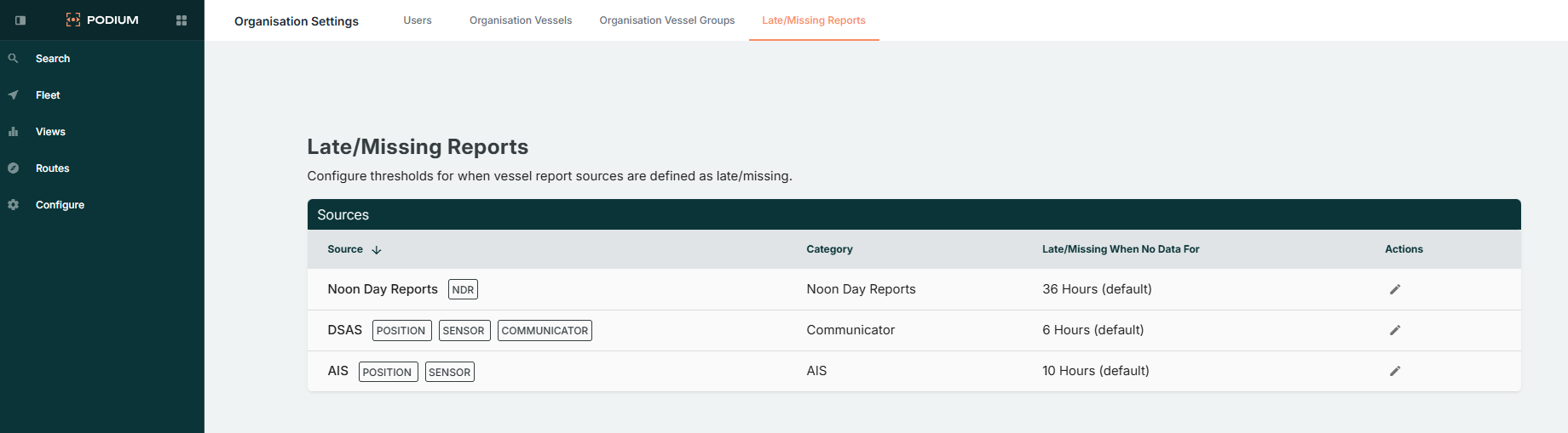
- Admin users can configure late or missing report notifications via:
Organisation Settings → Late / Missing Reports → Sources. - Set either a custom reporting interval trigger to define when alerts are generated, or can be left on the default setting.
Late or missing reports appear with warning indicators on the Fleet page and in vessel details.
View Historic Vessel Positions
- The white line on the Fleet map shows the historical track of each vessel.
- Click and drag the time scrubber to any point on the timeline to view the vessel’s position at that specific time.
- Specific dates/periods can be selected via the calendar icon.
- Historical tracks automatically load between the view’s start and end dates.
To view full position report history, select a vessel and open Full Details -> Details -> Position Reports
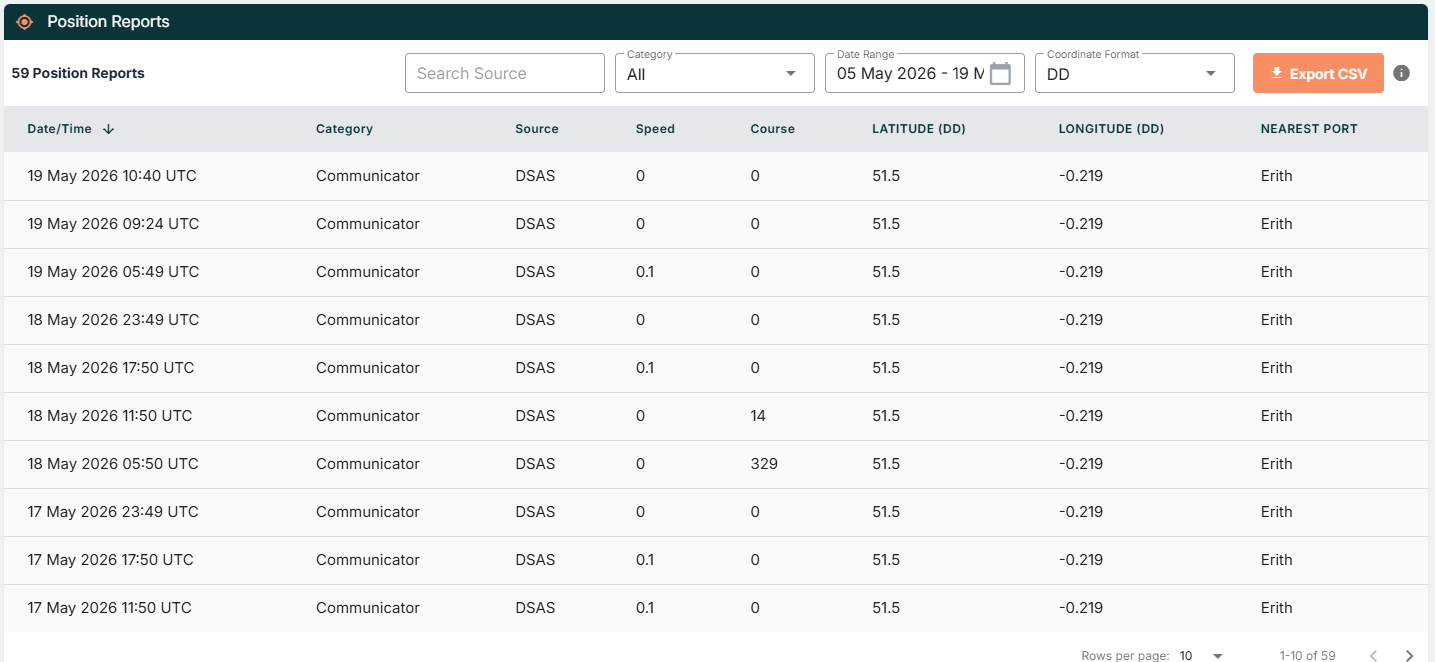
Here you can view and select any date range where required, including filtering based off positional source.
AMVER Reporting
AMVER (Automated Mutual-Assistance Vessel Rescue System) is a voluntary reporting system run by the U.S. Coast Guard to assist in maritime search and rescue operations.
- Navigate to the Fleet page and select a vessel.
- Select Full Details → AMVER tab.
- Select Enable AMVER to activate automatic reporting.
- A confirmation message appears upon successful activation.
- (Optional) Enable forward reporting to other systems:
- MAREP (Mediterranean)
- JASREP (Japan)
- AUSREP (Australia)
- CHILREP (Chile)
- Select Save to apply changes.
AMVER reporting automatically transmits position reports to the U.S. Coast Guard according to the vessel’s reporting schedule.
Enabled forward schemes receive identical reports to ensure regional compliance.
Latest Position, Timeline & Single Vessel View
Latest Position Mode vs Timeline Mode
Podium offers two main ways to view vessel data on the Fleet page: Latest Position Mode and Timeline Mode. You can also drill into a Single Vessel View for more detail.
Latest Position Mode
When Latest Position Mode is enabled, the Fleet page shows only the most recent position report received for each vessel.
- No historical track lines are displayed on the Fleet page.
- This view is ideal for quickly checking the current status and latest reported positions across your fleet.
If you want to view historical data on the Fleet page, click the Play icon at the top-right corner of the map and select a date range (up to 31 days) to switch into Timeline Mode.
Timeline Mode
When Timeline Mode is enabled, the Fleet page provides a more detailed historical view of vessel activity. You can enable it by selecting the Play button on the right-hand side toolbar and choosing a date range.
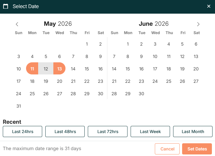
In this mode:
- Vessel track lines are displayed on the map.
- Any vessel that has reported within the selected date range will appear on the chart.
- Vessels that have not reported in the selected period will not be displayed on the map.
- When weather overlays are enabled, you can play historical weather data alongside vessel movements for the chosen timeframe.
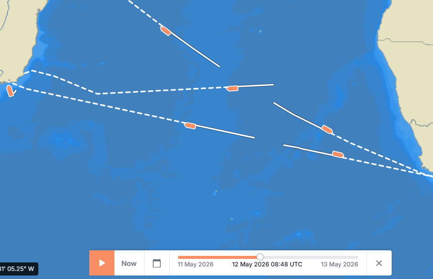
This makes Timeline Mode ideal for:
- Reviewing route history
- Analysing vessel movement patterns
- Investigating incidents during a specific period
To exit Timeline Mode and return to Latest Position Mode, click the X icon next to the timeline scrubber at the bottom of the page.

Single Vessel View (Single Position Tracking Mode)
To focus on one vessel and its recent movements, you can open Single Vessel View in either of the following ways:
- From the Vessels tab, select a vessel by name, or
- From the Fleet page, click directly on the vessel icon on the map.
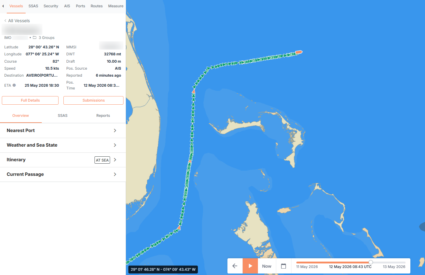
Once selected, the map will: - Zoom in to the chosen vessel, and
- Display only that vessel on the screen.
By default, Single Vessel View will show:
- The last 3 days of positional data for the selected vessel, counted back from the time of the last received report.
- A track line with positional report dots.
- The estimated position track continuing from the last known point.
This view is useful for understanding where a specific vessel has been recently, without the clutter of other vessels.
Viewing Latest Vessel Data When a Vessel Is Not Visible
If a vessel does not appear on the chart while using Timeline Mode, it likely has no reports within the selected date range.
To view its most recent data:
- Select the vessel name from the list.
- Choose Full Details.
- The Latest Data section will show the most recent position report received.
Summary
- Latest Position Mode
- Shows only the most recent position for each vessel on the Fleet page.
- No historical tracks are shown.
- Timeline Mode
- Shows vessel track lines and all reports within your selected date range (up to 31 days).
- Allows playback of historical weather data with weather overlays.
- Single Vessel View (Single Position Tracking Mode)
- Focuses on one vessel.
- Shows only that vessel on the map.
- Displays the last 3 days of positional data, including track line and estimated positions, counted from the last report.
- Missing Vessel in Timeline Mode
- If a vessel is not visible on the map, it probably has no reports in the chosen date range.
- Use Full Details to see its latest report.